


Ramsey Springs
Ramsey Springs has a long and interesting history. The property has been inhabited and used for recreation for many years. Learn more!
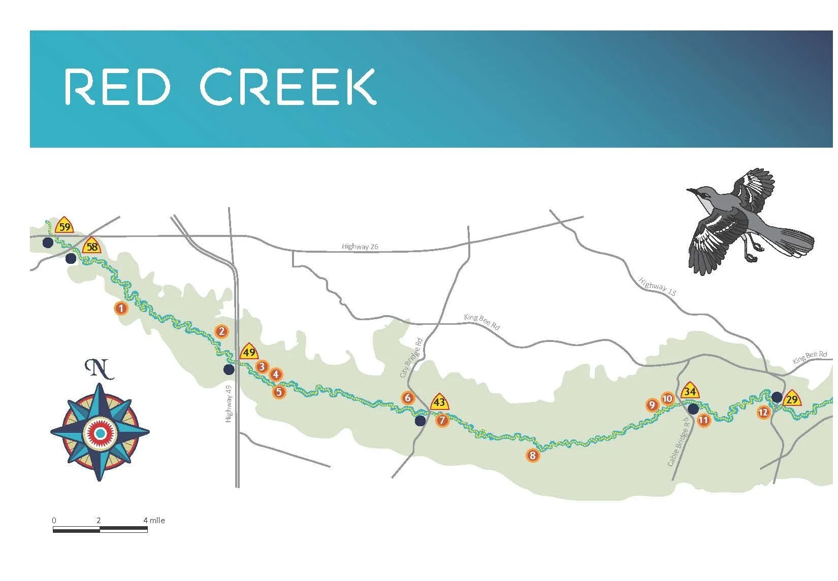
The 57.7-acre Ramsey Springs property is located in eastern Stone County on Highway 15. The property is bordered on the north and west by DeSoto National Forest and the State of Mississippi’s Red Creek Wildlife Management Area. It was purchased by the Land Trust in 2010, and soon thereafter was conveyed to the State of Mississippi. However, an agreement was arranged to allow the Land Trust to do some work on the property, to improve public access and preserve and celebrate the history of the property.
History
The Native Americans tell a story about two brothers, Chahta and Chikasa, who migrated with their people from the west. The brothers each had a sacred pole with them and they planted them in the ground at the end of each day’s journey. The next morning, the direction the pole leaned told them the path they should travel that day. When they crossed the Mississippi River, Chahta’s pole stood straight, so the Choctaw people knew they had found their new homeland. They settled in what would become modern-day Mississippi. Chikasa and his people (the Chickasaw) continued on to settle on the lands around the Tombigbee River in present-day Alabama.
Native peoples often settled on lands where two rivers join to ensure a constant supply of fresh water and game animals, and to take advantage of periodic flooding which replenished the soil and made crops more plentiful. Choctaw homes were rectangular or circular pole structures with walls made by weaving saplings and cane around the poles, often covered with clay or mud. Roofs were covered with thatch with a small hole to allow smoke from the cooking fire to escape. Low benches used for sleeping or storage lined the outer walls.
Mississippi was opened to settlement in 1798 when Congress organized the Mississippi Territory (which included Alabama until 1819) although the area around Ramsey Springs was part of Spanish West Florida until 1812. However, few settlers lived in Mississippi initially, and those who did were located primarily in Natchez or around Mobile. Outside of those areas, the territory was populated only by Choctaw and Chickasaw tribes. However, as economic conditions caused the Great Migration, during which massive numbers of Americans moved westward in search of fertile soils and forests of timber, “Mississippi Fever” began. Thousands of people headed for the region by any means possible, including by horse, wagon, boat, and foot!
By 1820, the population in Mississippi included 42,176 white settlers and 33,272 enslaved persons. William and Elizabeth Ramsey’s family were some of the white settlers who made the south side of Red Creek home in 1820. “Immediately on this bluff running back from the Creek was as excellent spring of as fine water as run out of the earth,” wrote Abiezer Clark Ramsey (1807-1891) in The Autobiography of A.C. Ramsey. By 1826, the Ramsey family had built a schoolhouse/church and established camp meeting grounds on the property.
Meanwhile, the Native Americans were being forced off the land altogether. By 1831, the Choctaw became the first Indian nation in the country to be wholly removed from their land.
Camp meetings were a summer tradition for settlers, where groups would gather in an open-air setting for preaching, Bible studies and meetings. Families arrived in horse- or oxen-drawn wagons after the crops were harvested and would pitch tents for a week or so to spend time with each other and a circuit-riding preacher. Gathering at a river was preferred for both fresh water access and baptisms. Each family brought their own cows and chickens for food, cooked on portable wood stoves, and buckets for carrying water. These camp meetings offered community, singing and dancing, and a diversion from work.

The early guests at the Ramsey Springs camp pitched tents and at night, torches and bonfires flared around the grounds. Visitors who came for the preaching at Ramsey Springs returned home with stories of the beauty of the site and its health-giving springs. Former Confederate soldier Abner Walker found relief from stomach ulcers by drinking from the spring in 1864; he subsequently moved to Biloxi and touted the healing properties of the spring. The waters were analyzed in 1886, and medicinal properties were listed for everything from skin disorders, blood and bowel diseases to liver and kidney complaints.
The early campgrounds led to the development of permanent lodgings. In 1897, the Ramsey family opened a new hotel with rates at 75 cents per day, four dollars per week, or fifteen dollars per month. At night, bands played and there was dancing on the rooftop, under the stars.
The new lodge hosted many activities. Many people took up rods and guns to fish and hunt for game of different kinds such as bear, panthers and other wild cats, wolves, and foxes. There were also deer, squirrel, and rabbits for the cooking pot along with ducks, geese, and turkey. People also swam in the lake, paddled in Red Creek and brought picnics to the sandbars.

“The water at the springs is ice cold and after getting in you do not want to come out. The bath is so refreshing that one can’t refrain from indulging many times a day. The picking and canning of berries of all kinds which abound in the adjacent woods affords a pleasant diversion for the women, several miniature canning factories being in evidence, and Heinz or any other professional preserver would be ashamed of his product if introduced to some blackberry jam formulated by the women.” (Daily Herald, June 24, 1913)
Roads to the springs in the early days of the resort were primitive. Gravel, dirt, and shell roads often washed out, and turned the 25-mile trip from Biloxi into an adventure filled with sudden drops, washouts, and a lot of bouncing over the ruts. Ferries across streams were interrupted by frequent deluges and swift-running water, making access difficult. Andrew Ramsey wrote in 1897, “The cheapest and best way for parties to come out to them from the coast is by their own conveyances. I will board their stock at cost (25 cents/day per head of stock).”
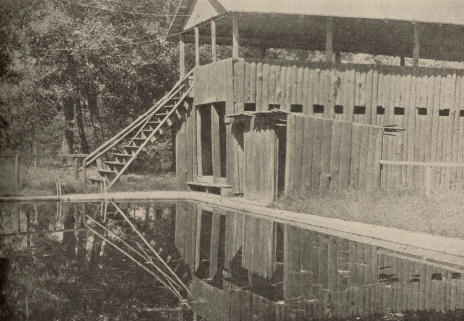
Development on the property reached its peak with the opening of the Mr. and Mrs. George Miller’s Ramsey Springs Hotel on May 12, 1923. The well-known hotel promised: “a constant flow of travel to this section during all the seasons of the year, and this means money turned loose that will find its way to many pockets.” The 35-room hotel and 12 cottages were constructed of rustic split logs and every room had hot and cold running water from the springs. The hotel had gnarled timbers and cypress ceilings, and was decorated with fat pinecones, vines, deer heads, hornets’ nests, taxidermy specimens from the local forest, and a great cobblestone fireplace. Generous porches invited breezes from across the pond. A swimming pool was fed from the spring, and had exceptionally cold water.
The food at the Hotel was renowned – fried chicken, spare ribs, cakes and pies. Sunday roast was a favorite tradition. An advertisement from 1925 described, “fried chicken with cream potatoe [sic] salad, vegetables, egg-cornbread and huckleberry pie dessert” for the sum of $1. It was good, old-fashioned home-cooked food.
The first automobile in Mississippi had arrived in Biloxi on June 26, 1900 and by 1913, there were a million automobiles in the U.S. The old roadways were modernized, cleared and graded for automobiles. New bridges at Cedar Lake and Hurricane Creek shortened the trip between Biloxi and Ramsey Springs by 12 miles and eliminated the need for the Lamey Ferry over the Tchoutacabouffa River. A trip that had taken many hours at the turn of the century could be made in less than an hour by 1932.
The rumored benefits of the spring water continued to be a draw for visitors. An advertisement placed in 1937 in The Enterprise, a Stone County newspaper, stated “Many medical doctors and scientists believe water from the springs passes through strata containing radium.” At the time, radium was considered to be a miracle substance — it glowed in the dark and salesmen promised it could extend people’s lives, increase their vigor, and make women more beautiful. Doctors used it to treat everything from colds to cancer and encouraged people to drink and bathe in the water. However, modern science has found that exposure to radium may result in an increased risk of some types of cancer, anemia, cataracts, broken teeth, and reduced bone growth, so drinking the water from Ramsey Springs is no longer recommended!
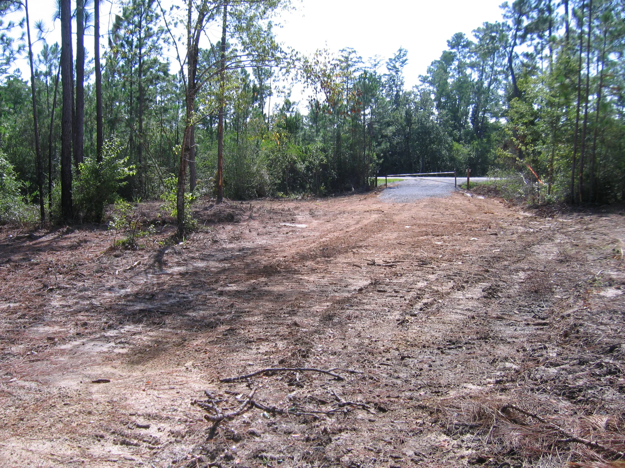
The hotel was demolished in 1961, a victim of changing tastes and increasing maintenance costs. Today, the brick walls of the former laundry building, some stairs and a heart-shaped pond are nearly all that remain of the Ramsey Springs Hotel. The property has been returned to a more natural state. A trail system has been established that leads visitors to the site of the former swimming pool and the famed spring. A boat launch and small parking area provides the public with access to Red Creek and interpretive signs have been installed to inform the public about the interesting history of the property.
The Land Trust is grateful to the Mississippi Department of Marine Resources, The Mississippi Coast National Heritage Area, the Department of Interior and the National Parks Service for funding that made research into the history of this property, trail improvements and signage possible.

Kayak Day Trip on Old Fort Bayou
Kayaking at Old Fort Bayou was great ! Join us next time!
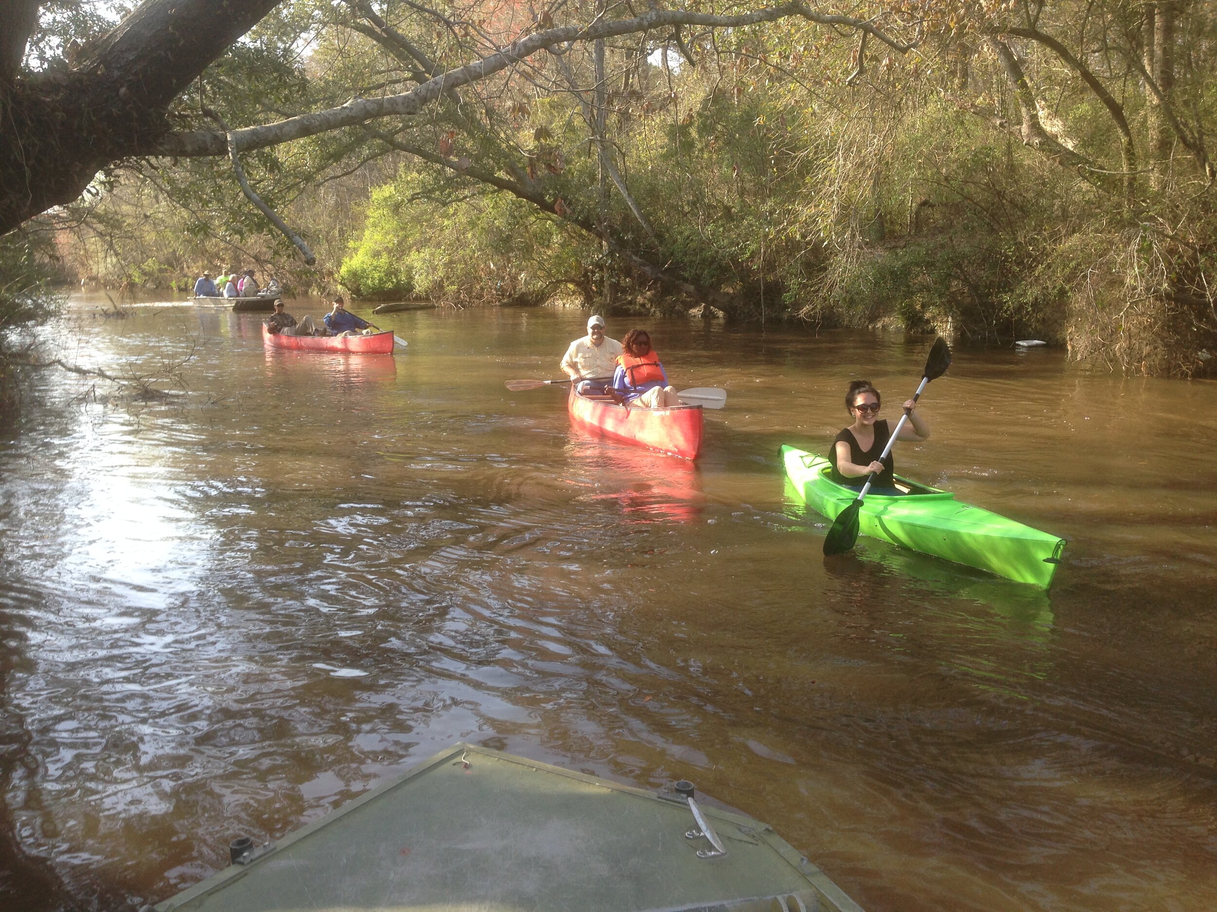
We had a great day on Sunday, April 25th, kayaking on Old Fort Bayou! We launched from the Shed BBQ shortly past noon, with many folks in kayaks provided by Everything Kayak. We started paddling upstream as a large group, then broke into smaller groups as we found our own pace.

We had litter grabbers and many of us picked up trash as we encountered it along the banks of the bayou. We saw a turtle, some fish and birds and butterflies. We encountered many friendly boaters, all of whom were considerate, who were enjoying the day in their own ways - out with friends or family, fishing, playing on the shore, enjoying the beautiful weather.
Several of our group were using pedal kayaks, and they seemed really fun and being hands free, would be an ideal option for people interested in fishing or photography. We stayed on the water until about 4:30, when we piled into the Shed BBQ to enjoy some pulled pork sandwiches and other delicious food and drink. We hope you will join us next time!

Restorations Part III: Techniques
Restoration Techniques — the final part of our three part series on the restoration of native ecosystems on the Mississippi Coastal Plain.
Species Removal
Fire is the natural force for maintaining a longleaf pine ecosystem. Dormant-season fires are used to reduce litter buildup when there is a significant amount of material that has accumulated on the ground which a fire would use for fuel. These fires remove the fuel to help prepare a property for restoration. Once a restoration has been completed, growing-season fires are used to maintain the structure, species composition and function of longleaf pine ecosystems. However, fire is not a practical solution for all properties because of adjacent land use (such as residential or commercial development where fire could pose a danger to settlements or nearby airports where smoke may interfere with visibility).
When fire is not appropriate for the removal of debris and non-native vegetation from a site, roller-chopping or mulching may be a necessary step in the restoration process. This involves using machines to remove large stands of woody vegetation from a property. When a site is less degraded, selective manual removal of vegetation to create canopy gaps or remove distinct stands of invasive species may be appropriate. This can be achieved using hand tools, but herbicide application is sometimes required, depending on the type of species that has colonized a property. The roots of some species are evolved to survive mechanical interference, so chemical methods are used in those circumstances.

Afforestation
While bottomland hardwood and bayhead swamp ecosystems are typically found in the same landscape as longleaf pine ecosystems, it is the restoration of a more natural hydrological regime that is key to their rehabilitation. Particular attention must be paid to soil type, nutrient availability and moisture. While flood-tolerant species are well-adapted to drier sites, they will not survive being planted directly into wet sites. Therefore, while the native ecosystems host a wide variety of mature woody vegetation, it can take significant time to re-establish a functional ecosystem. More tolerant species need to be planted and become established before species with more specific needs can be reintroduced as conditions become favorable. The stabilization of slopes, management of runoff and removal of water control structures must also be done slowly to allow woody vegetation time to adapt.
Planting woody seedlings is a common technique used by the Land Trust in all our restoration projects across all ecosystem types. In recent years, we have planted tens of thousands of woody plants on many properties across the Mississippi coastal plain. Most frequently planted is longleaf pine, but we also plant a dozen other species of woody vegetation that are native to the region depending on the specific conditions of a property. We also frequently plant native grasses and forbs and sow understory seed. Patience is key to restorations – while the removal of species has a sudden visual impact on a property, it takes many years for native species of woody plants to regrow into a forest system.
Stewardship
The natural forces which maintained native ecosystems here on the Mississippi coastal plain no longer function as they once did. Therefore, management of restored ecosystems is critical to ensuring their survival. A restored ecosystem will quickly become overrun with invasive species and revert to a degraded system without management. Successfully restored ecosystems require constant stewardship, but with it, they will thrive and provide habitat for native species. Please support the Land Trust so that we can continue doing this work on the Mississippi coastal plain so that future generations can enjoy the natural ecosystems of this beautiful area.

Restorations Part II
This is the second part in a series of articles about the restoration of native ecosystems in southern MS which we are publishing to help people understand the periodic actions we take on some of our properties. Please contact us at info@ltmcp.org with questions, comments or concerns – we would love to hear from you!
Property during a restoration
Other Common Native Ecosystems and the Case for Restoration
Bottomland hardwoods are forested wetlands that once covered vast acreage in the southeast on the lands adjacent to rivers, which would flood with the overflow from rivers during storms or heavy rains. These ecosystems are both characterized and maintained by the natural seasonal hydrologic regime of alternately wet and dry periods, with some parts of the system remaining more wet than others. Species presence varies depending on the hydrology of a particular area. Bayhead swamps are also forested wetlands, but they are associated with smaller creeks and tributaries. While they are similarly inundated with water, their soils tend to stay saturated most of the time.
In addition to managing floodwater, these ecosystems are important for helping to improve water quality by filtering nutrients, processing organic waste, and reducing sediment. They also provide significant food for a wide variety of native species. Because the soil of these forest types is typically rich in nutrients as a result of deposits of large amounts of leaf litter from flooding and also from the variety of species that grow there, the vegetation tends to produce a large quantity and variety of fruit and nuts. These ecosystems are also rich habitat for native species because of the variety of vegetation and availability of water.
The changes that settlement and urbanization brought to all our native ecosystems on the Mississippi coastal plain has resulted in fragmentation, changes to species composition and loss of biodiversity. One of the biggest challenges to reestablishing native ecosystems are invasive species. These are species that are non-native, but flourish under certain conditions in a new environment.

Before Restoration
Invasive species compete with native species for limited resources, and if conditions are favorable, can outcompete native species resulting in an ecological shift. Whereas native species evolved over time to flourish under the natural conditions alongside other native species, each filling a niche role, invasive species take advantage of favorable conditions and can dominate an area without natural balance. They do not provide the same kind of habitat, food sources or other ecological benefits as native species do.
Restoration of degraded ecosystems that have been overrun by invasive species, due to the fact that the natural forces of fire and flooding are no longer functioning as they once did is possible, but the techniques can be visually drastic. Removing invasive species, especially those which have taken over an area, can leave a property free of vegetation for a period of time until the native species can be re-established. In addition, a restored native system may look very different than it had when it was overrun with invasive species.

During Restoration

After Restoration
Once restored, stewardship techniques must continue to be used to mimic the types of disturbance (like fires and floods) that used to occur naturally to maintain restored native ecosystems, or invasive species will gain a foothold once again.
The next article in this series will detail some of the techniques the Land Trust uses to restore and maintain native ecosystems.

Restoration of Native Ecosystems of the MS Coastal Plain
This is the first part in a series of articles that outline the goals and procedures for the restoration of native ecosystems in southern Mississippi.
This is the first part in a series of articles that outline the goals and procedures for the restoration of native ecosystems in southern Mississippi. The Land Trust is publishing these articles to help the public understand periodic actions we take on some of our properties. Please contact us at info@ltmcp.org with questions, comments or concerns – we would love to hear from you!
Part I: The Native Longleaf Pine Ecosystem
The Land Trust often works on the restoration of native ecosystems. The longleaf pine ecosystem is an ecosystem we frequently work to restore, because it was historically very common here on the Coastal Plain. In fact, it covered a huge portion of the southern United States. Comprised of forests and savannas, the ecosystem occurred on sites ranging from wet, poorly drained flats to uplands. Fire would frequently affect the ecosystem, but the native species were adapted to not just survive, but thrive as a result.
Longleaf pines were a keystone species of the native ecosystem. In addition to providing fuel for fire, the growth habits of the longleaf pine tree helped encourage fire to remain at the surface of the ground only, and the trees themselves are uniquely adapted to survive in fire-prone environments.
Prior to settlement, fire would occur every few years, usually started from lightning strikes. The fallen pine needles from longleaf pine trees are highly flammable and would therefore actually facilitate both the ignition and the spread of fire. Fires would stay low to the ground because that was where the fuel was found. These “surface fires” moved through the ecosystem quickly because lightning struck regularly, so there wasn’t ever time for significant amounts of fuel to accumulate.
As seedlings, longleaf pines initially focus most of their energy on root growth. They grow a tuft of needles surrounding a large bud, but don’t grow a stem until their taproot has had time to grow deeply into the ground to reach water. Then they bolt, growing 3-6’ quickly which places the bud and needle tuft out of reach of surface fires. In addition, longleaf pines branch only near the crown, so there simply isn’t fuel in the form of branches for fires to be able to use as fuel to travel up into the canopy.

Herbaceous material thrives in the understory of longleaf pine ecosystems. Many of the perennial grasses that made up the ground story of native longleaf pine ecosystems respond to fire events by flowering more prolifically, resulting in an increase of seed production following a fire. The abundant variety of flora that flourishes in the longleaf pine ecosystem makes them one of most biodiverse plant communities in the world.
Fire helped the native flora maintain site dominance because other species that were less adapted to fire could not become established in the fire-prone ecosystem. This changed with fire suppression, which began as a result of settlement starting in the late 1800s. In addition, vast tracts of longleaf pine were harvested by the commercial logging industry for lumber and pine resin for the maintenance of wooden ships, and the land was replanted with faster growing species or kept clear for crops and cattle. Ultimately, the range of the longleaf pine ecosystem was reduced by about 97%, with the remaining ecosystem fragmented into isolated blocks.
The Land Trust works on restoration of longleaf pine ecosystems in order to reestablish some of the amazing biodiversity that flourished in these systems.
Stay tuned for our next post about the restoration of native ecosystems!

Meet Board Member, Jackie Parker
When she first crossed the Ocean Springs Bridge almost a decade ago and saw the amazing trees, Jackie fell in love and decided it was time to make a permanent change, settling in the beautiful city.

Meet LTMCP Board Member Jackie Parker!
One of the first things you notice when you meet Jackie is that her accent is not from here! Jackie was born and raised in England, but has lived all across the United States, from California to New York, for 30 years. When she first crossed the Ocean Springs Bridge almost a decade ago and saw the amazing trees, she fell in love and decided it was time to make a permanent change, settling in the beautiful city.
Passionate about the environment, animals, and social justice, Jackie is the president and co-founder of Harvest Trends, a data analysis organization assisting marketing departments to maximize potential. When not hard at work, Jackie enjoys kayaking, gardening, painting, reading, and building random projects out of wood. Her favorite outdoor space is the south side of Horn Island “holding a cold beer in one hand and a garbage bag in the other” to help keep our beautiful landscape pristine.

In 2017, Jackie’s friend Beth asked if she would donate some of her art to the annual Land Trust fundraising event. She donated two items, one acrylic painting and one oil painting, both with trees as the focal point. In late 2018, again at Beth’s recommendation, Jackie joined the Land Trust Board of Directors as the Treasurer. She wanted to help protect the beautiful trees and waterways that caused her to fall in love with the area.
One of her favorite things about joining the Board was learning about the work the Land Trust does to make protected spaces available for environmental education and public access. Every parcel of conservation land acquired by the Land Trust which can be safely and sustainably adapted for public access is enhanced with trails and educational signage. She thinks more people should be involved with the Land Trust to help preserve the beautiful landscape that inspires artists, provides water quality, and connects the community to the land.
So, what’s a “blueway”?
We have done a lot of work on the blueways in southern MS! Make sure to check back soon to learn about our Kayaking the Blueways fundraiser!
And why has the Land Trust been helping people get out onto the water here in southern Mississippi for over 20 years?
Blueways are defined as “a stretch of river, a shoreline, or ocean that has been mapped out with the intent of creating an educational, scenic, and challenging experience for recreational paddlers. The Land Trust has been involved in increasing access to local blueways for many years.
We have established and improved blueways, protected the land along the banks of blueways and provided access to blueways. We’ve cleaned up blueways, removing truckloads of litter and debris and downed trees to make blueways navigable and enjoyable! We even helped to create and publish a Design Guide for others to establish new blueways and tell the public about it!
There are so many great blueways on the Gulf Coast; see the list here: https://gis.dmr.ms.gov/Blueways/. You can print individual maps by clicking “Download PDF” under the heading of the blueway you’re interested in.
Paddling on the blueways is good for your health and it’s super fun! Kayaking the blueways is a great way for people to socialize at a distance, enjoy nature, do some birdwatching or fishing, or help clean up our coast by picking up litter while enjoying the water.
And that’s why we do it! It’s what the Land Trust is all about! Protecting and enhancing what makes the Gulf Coast special, so that you and I, our friends and future generations can all enjoy it. See you on the water!

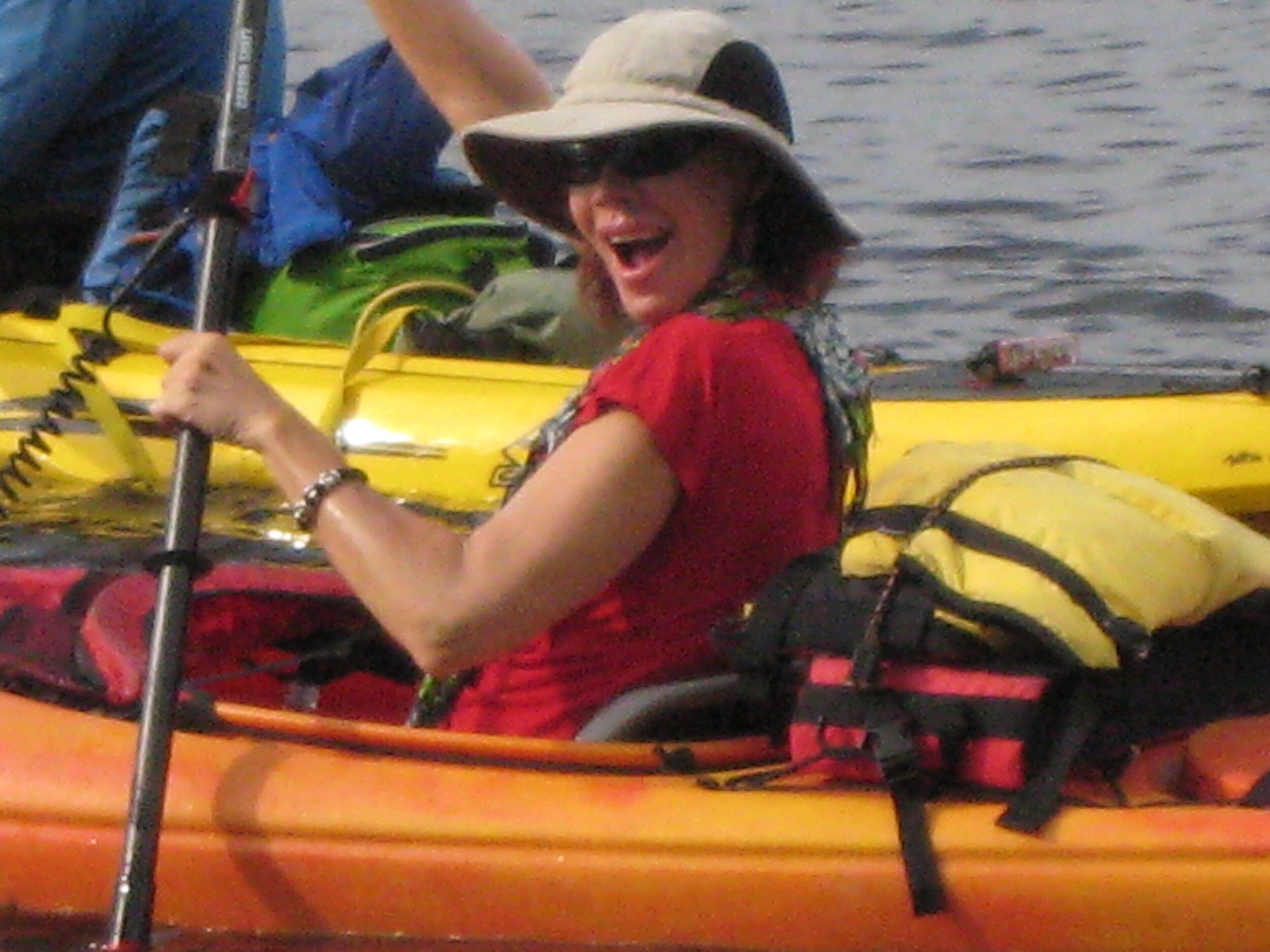
Let’s get ready for Kayak Season!
Keep your eyes peeled for an exciting opportunity to help the Land Trust out by kayaking!
Kayaking is a low impact activity that can improve your endurance, flexibility and cardiovascular fitness and increase strength. Plus, it’s a fun way to get outdoors, spend time fishing, bird watching, or be socially distant but still hang out with friends and family. Kayaking is also a great opportunity to help clean up our waterways — take a bag with you to collect trash!
Keep your eyes peeled for local wildlife, native trees and flowers and the many different species of birds who inhabit or migrate through the region.
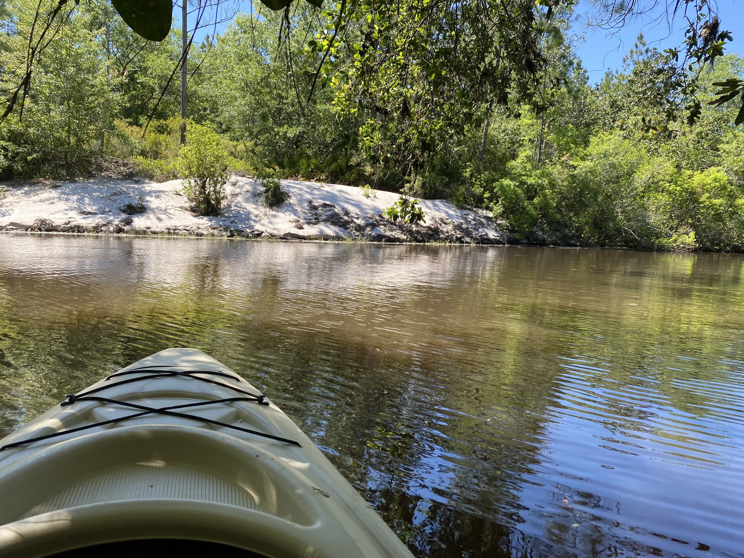
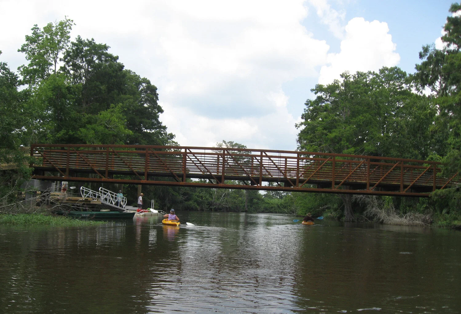
A few of the good kayaking waterways located in coastal Mississippi include Red Creek, Old Fort Bayou, Wolf River, Turkey Creek and the Tchoutacabouffa River. While paddling these waterways you’ll glide past some of the properties protected by the Land Trust, including Twelve Oaks, Schwan, Ramsay Springs and Cedar Lake Island!
Always be prepared for your kayaking trip by making sure you have the correct paddle, flotation devices, drinking water, first aid kit, sunscreen and proper clothing. Springtime is a great time to kayak, so get your paddles out, your kayak cleaned up and your life jackets ready and you might see us out there enjoying the rivers ourselves!
Keep your eyes peeled for an exciting opportunity to help the Land Trust out by kayaking! We’ll be posing about it next week!

Tree Plantings at LTMCP
LTMCP will be planting over 9,600 trees this year
LTMCP will be planting over 9,600 trees this year across several restoration sites. Turkey Creek, Schwan, and Bayou Auguste will all receive a mixture of 14 different tree and shrub species including Wax Myrtle, Green Ash, Sycamore, Cherrybark Oak, Laurel Oak, Willow Oak, Cypress, and Persimmon. The Land Trust will be utilizing several volunteers through Climb CDC to get the trees planted.
Planting hardwood trees after the last frost of the season, but before Spring blooms, allows for the roots of the young saplings to become better established. This increases the chances of survival. The trees planted on Land Trust sites help to provide food and shelter for wildlife. Air quality is improved by the trees intake of carbon dioxide in order to produce oxygen.

Meet Board Member, Russell Evans
The Land Trust is grateful to Russell for volunteering his time to help make LTMCP a strong and successful organization dedicated to land conservation and is looking forward to working with him well into the future.
In 2008, Lucedale Mayor Dayton Whites was serving as a board member for the Land Trust for the Mississippi Coastal Plain. Mayor Whites approached fellow Lucedale resident Russell Evans to join the Land Trust as part of its advisory board. Russell began working with Land Trust members, and staff and was inspired by their passion for the organization and its mission. When Mayor Whites’ term on the board expired in 2001, Russell stepped in and filled the role on the LTMCP board as a representative of George County.
Russell attended Mississippi College in Clinton Mississippi where he earned his degree in Business Administration. In 2010, Russell opened R Evans Realty, LLC in Lucedale as a Broker/Owner with a vision of offering a service to property and home buyers and sellers that would be above board at every turn. His commitment to integrity and the environment has made Russell a valuable board member for the past 9 years. He loves to spend time outdoors especially at Ship Island and exploring inland waterways like Wolf River.
Russell is a lifelong resident of George County, and has been instrumental to LTMCP in protecting and taking care of Lucedale’s Depot Creek Greenway. When Russell found out the trails at the Greenway needed to be closed due to damage, he began working with the Land Trust, members of the City of Lucedale, civic organizations, and community leaders to raise funds to fix the trail and re-open the popular nature area.
Terms for LTMCP board members expire after completing three 3-year terms. Russell is currently finishing up his last term on LTMCP’s board of directors. He will continue to be a part of the Land Trust’s Internal Affairs committee assisting in land stewardship and management. The Land Trust is grateful to Russell for volunteering his time to help make LTMCP a strong and successful organization dedicated to land conservation and is looking forward to working with him well into the future.

Forest Bathing
There is no doubt; we are living in turbulent times. Try “forest bathing” to ease your mind!
There is no doubt; we are living in turbulent times. But we have such opportunity here in southern Mississippi to take advantage of our beautiful natural environment to soothe ourselves during times of stress and upheaval. I took a lovely hike on New Years Day and enjoyed the serenity of a longleaf pine forest.
The soft sounds of the wind moving through the trees and grasses, the distinct smell of the pines, the grasshoppers and birds flying about and the warm sun all combined to provide me with a sense of calm and serenity. There isn’t just one place that can meet the need – find a place that suits you! It may be the sound of moving water, or the smell of the Gulf, or the rustling sound of deciduous trees in the breeze that really brings you peace. Try different places that appeal to different senses.
The Japanese have a term for this practice – forest bathing. It does not need to involve a hike through the woods, it can come from simply being there. Spending time in nature; connecting to place with your senses. You might find a picnic, yoga, meditation or bird watching help to connect you to nature more, bringing you more comfort and relaxation.
Numerous studies have shown that forest bathing has significant health benefits, including reduced blood pressure and decreased feelings of anxiety and depression. And these days, we can all use a little less stress. Seek nature.

New Year, No Litter!
Let’s all make a New Year’s resolution to stop littering!

A few weeks ago, I was working with a group of young adults on one of the Land Trust properties when a truck stopped, rolled down his window and literally threw garbage right where we were standing, laughed and sped off. The horrible thing about this story is that it’s not just a one time thing…we pick up mountains of trash from this area to get it out of the ditches and keep it from going into the creeks and waterways of southern Mississippi.
Let’s all make a New Year’s resolution to stop littering! Let’s work together to have a nice clean place to take a nature walk or go fishing without having to hook an old tire or plastic water bottle.

Litter in Turkey Creek
Deliberate littering, illegal dumping and non-deliberate actions such as having a piece of paper blow out of your car are all to blame for contaminating our environment. It is important to acknowledge bad behavior, and put a stop to it! There is a person behind every piece of debris we find in our waterways, from the cigarette butts, bags, food wrappers, caps, lids, glass bottles, beverage cans, cups, plates, forks, knives, spoons, straws and stirrers to the fast food containers.
Litter not only distracts from the beauty of our green and blue spaces, but it is hazardous for our drinking water, detrimental to our recreational areas and lethal for our pets and wildlife! Let’s all please remember to deposit trash in receptacles, recycle whenever we can, and remember that when we do, we’re doing our part for our family, friends, neighbors, pets and wildlife.

Some of the tires removed from Turkey Creek
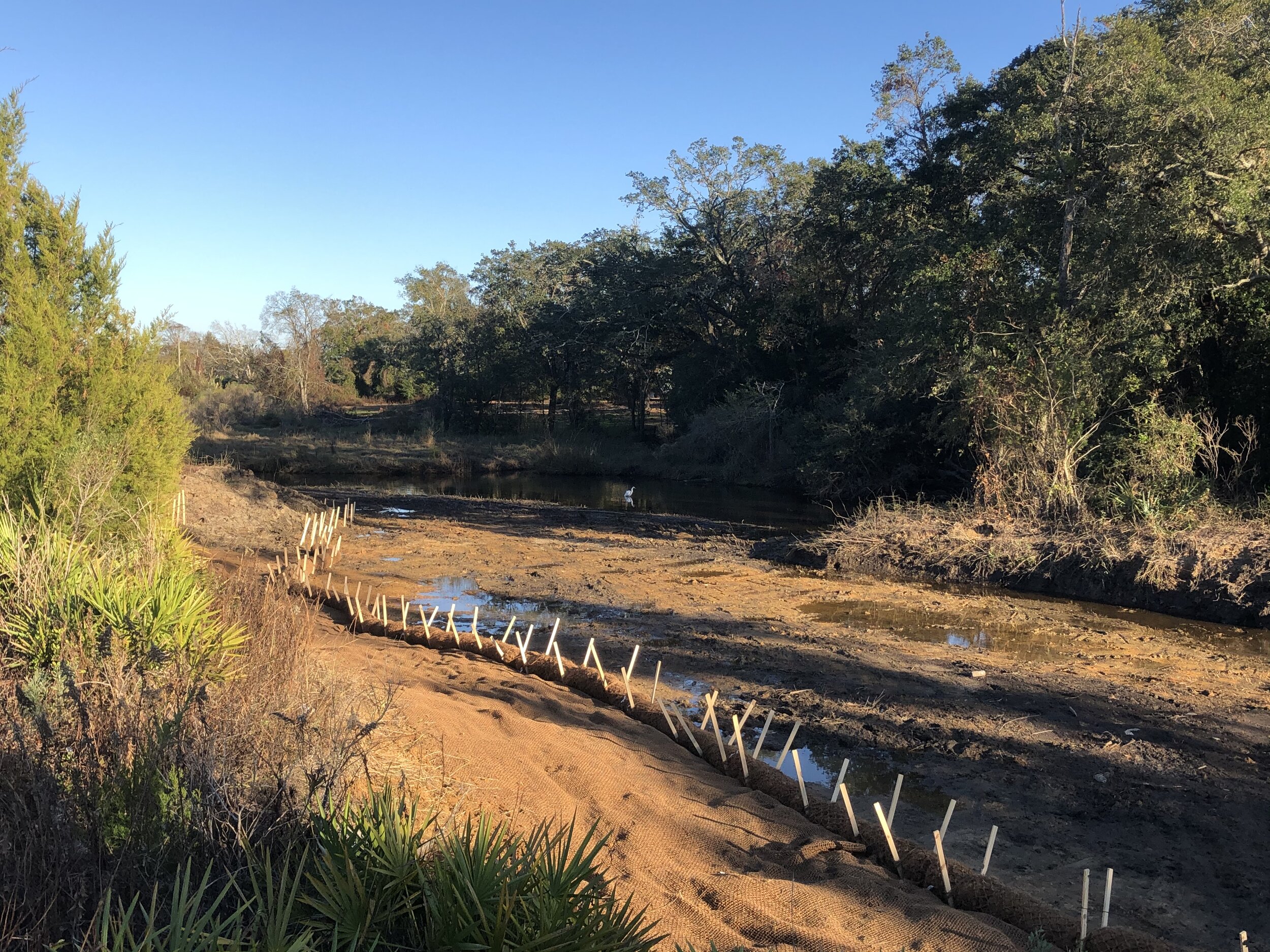
Bayou Auguste
Bayou Auguste is located in west Biloxi. It is a tidally influenced estuarine marsh system home to countless birds, fish, and even an alligator or two.
Bayou Auguste is located in west Biloxi. It is a tidally influenced estuarine marsh system home to countless birds, fish, and even an alligator or two. Siltation of this system degraded the bayou to a point where native plants and animals were struggling to survive here. Siltation is a form of water pollution caused by soil erosion that unfortunately occurs frequently in urbanized waterways in which silt, clay, and other sediments remain suspended in the water, causing poor water quality, increased flooding potential, and the loss of plants resulting in the destruction of suitable breeding grounds and habitat.
The Land Trust partnered with Cypress Environmental in order to lead the engineering design and construction administration. The Gulf Coast Community Design Studio organized and assisted volunteers from Climb CDC in an effort to restore Bayou Auguste. First, 1,174 cubic yards of material was removed, and the area regraded to a slope that is suitable for the native marsh plants that once dominated the bayou. Invasive species were removed, and erosion control materials were installed to stabilize the bank in areas vulnerable to the tidal action that impacts the site. Finally, 5,900 native marsh grasses were planted, including Juncus roemerianus, Spartina alterniflora, Spartina patens, and Schoenoplectus californicus. An additional 30 native trees were planted on the banks of the bayou in order to further stabilize the shore and provide additional biodiversity to the area for improved habitat.
This is an example of work the Land Trust does in our community to improve the land, even on property we don’t have the ownership of.
Please check out the following websites for further information on our wonderful partners!
Cypress Environmental: https://cypressei.com/
Gulf Coast Community Design Studio: http://gccds.org/
Climb CDC: https://www.climbcdc.org/

Shaw Homestead
The Shaw homestead is open to the public when the Land Trust holds its annual Historic Celebration at the property. Stay tuned for the next opportunity to visit this unique place!
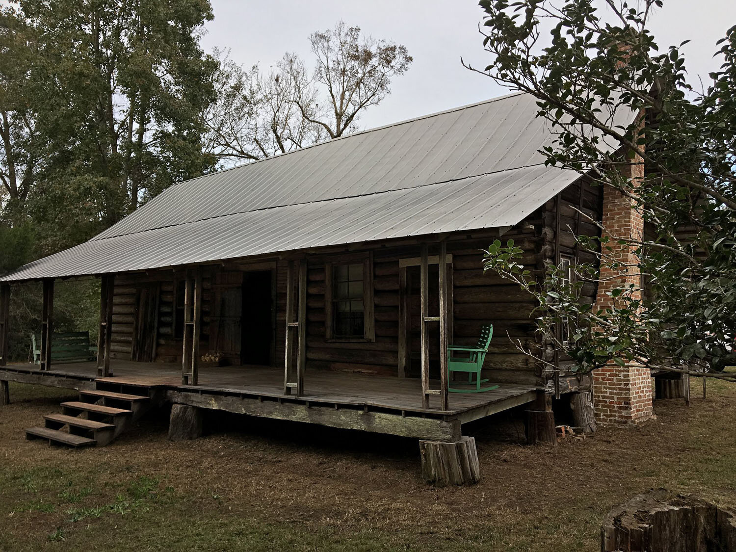
The Shaw homestead was built in the 1880s under the conditions of the Federal Homestead Act, which encouraged adventurous settlers to move to Southern Mississippi. The original “dogtrot” house with detached kitchen was constructed by Jules Ladner, but by the turn of the century, Melvina and Gilbert Shaw settled there, and they made some small additions to the building.
Although the kitchen was central to homestead life and several family members shared the limited living quarters, many daily activities took place outside on the grounds and on the house porches. The yard immediately around the house was fenced for chickens, and outbuildings dotted the property including a smokehouse, jar house, corn crib, barn, sweet potato house, outhouse, garage, well and tractor shed. Many of these outbuildings remain.
The house had no electricity, plumbing or running water until 1951. Four generations of the Shaw family lived in the house until 1969, when the last occupant evacuated for Hurricane Camille. The house remained unoccupied and largely untouched until 2006, when it was donated to the Land Trust for the Mississippi Coastal Plain. Since then, some improvements have been done to stabilize the house and outbuildings, but more work remains to be done.
We are delighted to announce a partnership with Coast Electric, who is sponsoring this property to make some improvements and help with annual maintenance.
For lesson plans, you can visit www.wholeplaces.net

Riley Road
Reilly Road provides habitat for the critically endangered Mississippi sandhill crane, and features a hiking trail.

The Land Trust owns a 43.3-acre property behind a residential settlement in Ocean Springs, which includes a walking trail and small pond which drains into Davis Bayou.
This property is in very close proximity to the Mississippi Sandhill Crane Refuge and contains suitable habitat and hunting grounds for the critically endangered species.

Logtown Blueway & Possum Walk
Bayou Bogue Homa provides both kayaking and hiking options!
The historic site of Logtown on Bayou Bogue Homa provides wonderful recreational opportunities! The Land Trust is proud to have been a part of establishing the recreational access here.
After the Weston Mill closed in 1930, the population of both Logtown and the Point (the African-American community located across the bayou from Logtown) steadily declined. However, the residents who stayed enjoyed Sunday church picnics, bought supplies at Forest and Eldora Summers' general store, fished, hunted turkey and wild boar, went to Moultrie's Tavern in the Point, and had parties known as "come-overs." And, according to local lore, moonshine brewing was common until the end of Prohibition! The Point had its own cemetery, which lies northeast of the Logtown cemetery, between the forks of the Bogue Homa. When NASA announced plans to build Stennis Space Center in 1961, the process of relocating residents living within the acoustic buffer zone began, and Logtown and the Point were soon no more.
Today, there is a kayak launch to help you get your boat into the water safely. The bayou connects with the Pearl River, which is the boundary between Mississippi and Louisiana, a few hundred feet to the west. Stay to the east to enjoy a lazy paddle in the freshwater swamp, or connect up to the river and enjoy as much adventure as you have the energy for!
The Possum Walk Heritage Trail is also accessible here. It is a 3.1-mile “there-and-back” trail that moves hikers from the historic site of Logtown to the Stennis Space Center’s Visitor’s facility. A beautiful bridge spans Bayou Bogue Homa, then boardwalks lead hikers through pine woods and swamps. The trail opened on August 14, 2013 to hiking and cycling.
Follow directions to Logtown on your phone; the trailhead is just a little further than the historic cemetery.


Henderson Point
The Enchanted Nature trail in Pass Christian is open!

The Henderson Point property was generously donated to the Land Trust in December 2002. The ecology of the landscape in South Mississippi reveals a great secret that not many know: everything is connected. Our habitats transition gracefully into another, mostly driven by elevation change and how water moves through the system. At Henderson Point, a mixed pine/hardwood forest hides smaller habitats such as freshwater marsh. The forest grades into a (slightly) brackish marsh that is subject to tidal flow but does not get much salt water except during extremely high tides. Not far north of Henderson Point, Mallini Bayou weaves in and out of the area transferring brackish water from St. Louis Bay. To the south lies Hwy 90 and the Harrison County Beach, separating Henderson Point from the Mississippi Sound.
The Land Trust established a half-mile loop called the Enchanted Nature Trail on the property, which overlooks the marsh and features some animal wood carvings. However, the facilities along the trail have sadly been vandalized or stolen, including the signs featured above, and Hurricane Zeta caused trees to be downed and debris to be spread on the trail.
We are thrilled that this property has been chosen to be supported by the MEMBERS of Coast Electric through Operation Round Up and their Community Trust, in partnership with the Gulf Coast Community Foundation, which is enabling us to fix some of the existing boardwalks and install some new ones this spring! Thank you!
The property is located near the intersection of U.S. Highway 90 and Fort Henry Road in Pass Christian. Turn North onto Fort Henry Road from U.S. Highway 90 take your first left into the parking area.

Reaccreditation
The Land Trust is happy to report that we have received our reaccreditation from the Land Trust Accreditation Commission.
The Land Trust is happy to report that we were recently reaccredited by the Land Trust Accreditation Commission. Accreditation is a mark of distinction, recognizing land trusts that meet the national quality standards established by the land conservation community. As of October 2020, we are one of 442 accredited land trusts in the United States.
Accreditation is a rigorous process, and takes a significant amount of time and effort for staff. So, why bother? According to a recent study, 85% of public agencies and foundations say accreditation increases their confidence in land trusts, and 79% said it factors into their decision-making. In addition, 83% of landowners said accreditation increased their confidence that their land would be protected in perpetuity. We think those are compelling reasons!
We are grateful for the accreditation process, which gives us the opportunity to review our own procedures and policies, so we can make sure we are operating at the highest level. Because we want you to believe in us!

Opposums
What do you think about opossums?

What do you think about opossums? I always thought of them being dirty and nasty and pretty disgusting creatures! We find them in our garbage cans and lurking around in our yards at night. But, after doing a little research about this mysterious night creature, I found out that they are really misunderstood and interesting. Yes, I said it, interesting!
The opossum is the only marsupial found north of Mexico and they carry and nurse their babies in their pouch for the first few months of their life. After that, they like to ride on their momma’s back till she has had enough! The funniest characteristic of the opossum is its ability to play dead in front of its predators. When they experience intense fear, it will seize up and flop to the ground where it will remain for hours staring blankly and sticking its tongue out. Hence the phrase, “playing possum”. It is totally an uncontrollable involuntary reaction triggered by stress!
Opossums gobble up 90% of ticks that attach to them and according to the National Wildlife Federation a single opossum consumes 5,000 ticks in a season. They also eat snakes and are immune from all snake’s venom except the coral snake. Opossums aren’t dirty either – they clean themselves with their tongue and paws thoroughly and frequently. They use their tails as an extra arm to help them build their nest or climb trees as I have seen on many of the Land Trust’s properties. Opossums build their nests along tree lines close to rivers and streams.
So the next time you see an Opossum in your yard or garbage can, remember he is a really cool marsupial that does amazing things for us!

Thanks to you…
We are so grateful for you!

We have protected 2,973 acres of land through fee ownership
We planted 8,500 trees (including 12 different species) along Turkey Creek in Gulfport
3 critically endangered Mississippi sandhill crane chicks were born on Land Trust property
Over 500 acres of land have been restored using prescribed burns
Nearly 200 young people have gained work experience by working on Land Trust property through Corps service
We have protected 7,682 acres of land using conservation easements
About 200 critically endangered dusky gopher frogs live on Land Trust property